|
OK - this
write-up is long. Almost a ramble - but it's kinda fun as there is a
lot packed in these few days. This isn't a "best laid plans" type of
trip, more like "kid in a candy shop" scramble!
This
weekend I'm hopping down to the Denver area to work on some projects
with Tom. The goal is to arrive Friday evening and work through
Saturday and maybe Sunday. Leaving home early I figured I could do the Celestial Seasonings
factory tour and perhaps the Coors brewery tour. Friday will only see
one as I'm getting out of town later than I thought. Celestial
Seasonings is closer (Boulder) whereas Coors is in Golden - another 25
miles down the road.
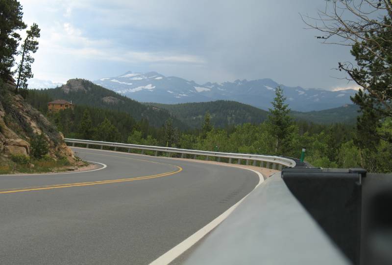
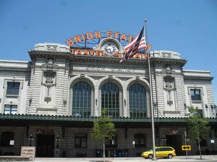
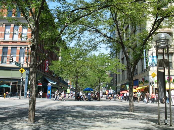
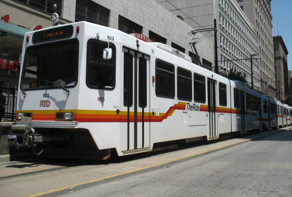
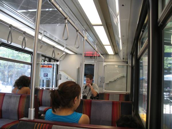
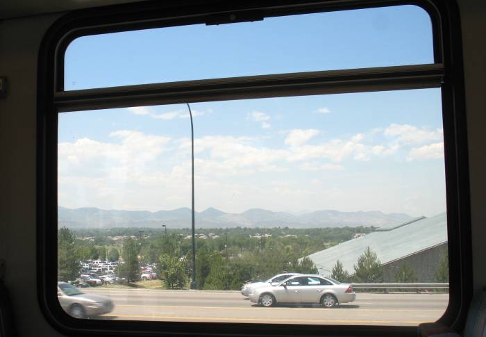
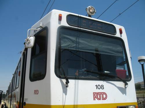
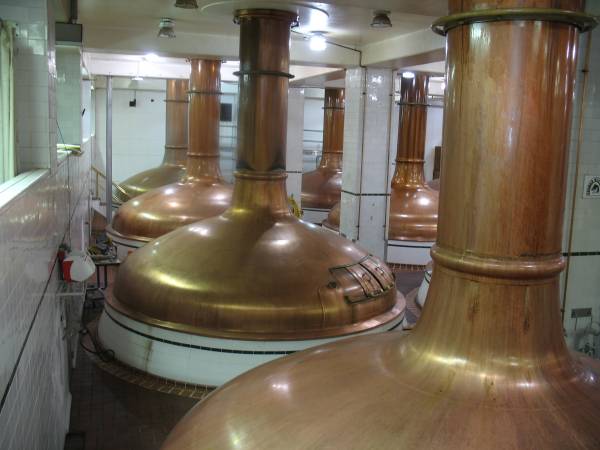
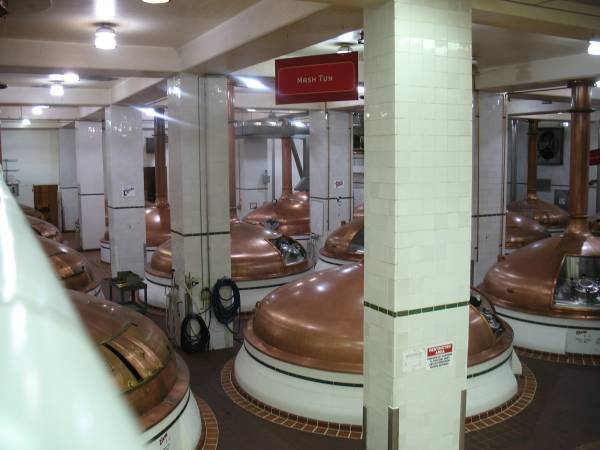
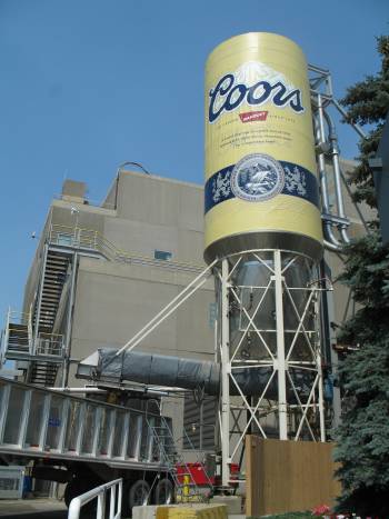
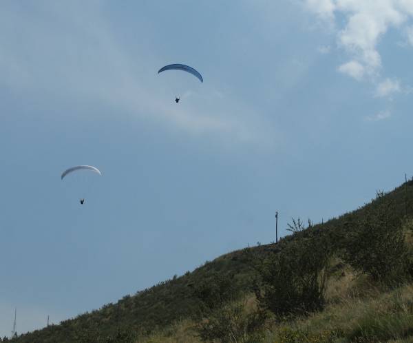
On the Celestial Seasonings tour (no photos allowed) I learned a bit about tea (the three kinds - green, black, white - all about the same but differentiated in how and when the tea plant is harvested) and that they use other herbs to make combinations (herbal infused teas). They have something like 102 different ingredients to comprise 97 flavor combinations. This is their only (manufacturing) plant. Their ingredients arrive from all over the globe. Their decaffinating process (for those lines of decaffinated tea) takes place in Austria or Germany and uses a non-water-based decaffinating process (CO2 is it?). They tout their "spice room" where they store spearmint and peppermint. These spices are physically separated from the other ingredients until needed as they are strong. Everyone on our tour (about 12 people) stayed in the room but some commented that their breathing was affected. My eyes were starting to water. Menthol, a naturally occuring alcohol, is a large part of the reason. The guide said that when a new shipment arrives you can taste the peppermind / spearmint just by breathing via your mouth. After walking through the ingredient storage areas, the initial ingredient prep area (sifting / sorting / filtering) we walked through the packaging area. Five assembly lines are available. Unlike other "behind glass" tours we were on the floor with the machines (had to wear hair nets, don't stick your finger in the moving parts). The mixed ingredients, in a hopper above, are dispensed onto "tea bag" paper, the paper is cut, folded, sealed to form a tea bag (with requisite string and grab end). The bags are arranged and placed into boxes that had just been automatically assembled, the boxes folded shut and plastic wrapped. The consumer boxes are then placed into shipping boxes and the shipping boxes palletized. One robot arm takes shipping boxes from three lines and places them onto respective pallets. Space-wise, a compact operation - especially considering the upcoming Coors brewery tour. While I didn't have time for the Coors tour today I had just enough to do some exploring. Down to Boulder I head. A busy downtown (it is a Friday afternoon) with expensive and clean looking buildings. Toss in some hippy / woodsie people for some character. Interesting place. I could see making a stop back and walking about the multi-block mall area. While Boulder's downtown was interesting, it was meerly "in the way" between the prior tour and CO-119 - a twisting two-lane connecting Boulder and Nederland (which I shall find out is called "Ned"). CO-119 is, at least on a Friday afternoon, a BUSY two-lane, twisting in a canyon with the Middle Boulder Creek and a bike path surface that had a prior life as a railroad line. I was in a "follow the leader" pack of cars snaking uphill turn after turn. Partway up, with a clearing nearby, I saw a guy hitch-hiking, guitar case in hand. He wasn't carrying an axe (nor a case of beer - if you recall those humorous TV commercials) so I figured why not. Interesting character. He was heading up to Nederland - and the first to tell me the abbreviation of "Ned". His goal was to play and sing that evening. After a few miles he pulled out his guitar and played a song or two - Aerosmith is what he does. I'm thinking he doesn't make a living at this - which is maybe why he was hitch hiking in the first place. Dispensed at the local grocery store parking lot so he could get some "protein" we parted. I should'a asked him for a picture. Life is like a box of chocolates... South-Southeast from Nederland, and heading towards my destination, is CO-72. Part of the attraction here is, well, more good scenery, though also is the rail line heading up the mountains from Denver - the same that goes through the Moffat Tunnel and points west. For a small section of this road the rail line is alongside. Before long I was at Tom's and we were working. A shelf in the garage, some lights in the basement, basement insulation re-working. Saturday and Sunday were consumed rather quickly. Monday I'd process the miles back to Fort Collins. Though like the winding road to Tom's it'll be moreso from Tom's. Having spent several Saturday nights at Tom's, the usual Sunday Church routine also happens. En route to the Church is an end station to Denver's Light Rail line. With trains being of interest it was simply another mental ToDo item. I think I'll give it a shot. I've ridden local rail lines in Chicago (The El and Metra), Washington DC's commuter rail line and the subway in some larger eastern Canadian city Toronto/Montreal/Quebec? (a rubber wheel on concrete subway - quiet). Up and moving at my usual time I'd not have to deal with the morning commute rush (how's that for saying I like to sleep in). Car parked at the parking lot I figured out how to purchase a ticket. <rant>UGH - Never feed a $20 into their machine for a $2.75 one-way ticket as it will spit out SEVENTEEN one-dollar coins [plus the one quarter]. I feel like a Canadian with my pockets heavily weighted with coins. I can't wait to off-load these things. Change from a municipal / government entity - pushing those ill desired coins onto the public.</rant> Aside from that diversion in coins, the light rail system seemed quite nice. Clean, orderly, quick - it works. Not knowing where I wanted to go to in Denver I simply picked a stop and disembarked. A couple blocks earlier we passed by a mall area that was filled with people. The mall was an old roadway that was now a mass of people, street vendors, and still roadway activity with busses and an occasional car. The busses are frequent, free and travel from one end to the other - maybe 14 blocks in length. Hop on even if it's for only one block. I walked down one side, stopping to talk with Theresa, one of the mall employees that helps tourists with questions. I eventually made it to the end at Union Station, took some photos, and started walking back. With lunchtime at hand, my first meal of the day, I stopped at a vendor for some delicious food - paid for with those one-dollar coins (and a "more of these" look from the vendor). As the day rolled on so the heat also came up - I decided to jump a bus ride to the other end - the State Capitol. Some photos at that end I walked back to the train. I only needed to remember "D Line" as I was at the last station on the line - no missing my stop. Train and Denver downtown life - check. Coors Brewery Tour [free!] - next up. A couple quick stats - this brewery can produce the largest volume of beer of any brewery in the world. This July 4th week is also their busiest in regards to tours (aka "Hell Week" by the tour guides) - and yes it was BUSY! They had multiple tours going on. Our tour was an "out of sequence" tour fitting itself in around other tours. Out of sequence as in the sequence of steps in beer production. Our tour guide, Dee, handled it well. She had fun telling us what happens when you're a new(ish) tour guide and the building evaucation alarm sounds - what do you do with a tour load of people when you can't find an evacuation route sign! The brewery tour uses shuttle busses between the parking lot and the visitors entrance. Waiting in line for the next bus I spoke with an assistant regarding the paragliders launching off the mountain that was nearby. She told me it was Lookout Mountain, of the road to get up there, and that "Buffalo Bill's" gravesite is up there - off I headed. About 1/2 way up two paragliders were in the air and floating down. Some photos and some video I kept moving - up. I had looked at the map enough to see that the roadway would pop out at I-70 where I could jump onto it to head home (who here thought I'd stop at Buffalo Bill's gravesite?). I wasn't quite sure which route to take heading home so I pulled into a park-n-ride at the top of the first good climb west of Denver. Parking, at the same time as I, in the last spot with some shade was a gent in a white Volvo. We started chatting and before long an hour + had passed. Brock works, partly, in Denver and was taking a break on his drive home - about another 30 minutes west - up near St. Mary's Glacier, northwest of Idaho Springs. Early on he said that there's good pizza at BeauJo's in Idaho Springs - about 20 minutes west of here. I commented that I had only had 1/2 bottle of water and 1 beer (brewery tour) to eat today (forgetting about the Denver mall vendor small lunch) and that pizza sounded good. We kept talking about cities and the differences of people in the communities. He's been here for 22 years and had one comment that a lot of vehicles break down at the top of this first climb - not more than 20 minutes later an 80's to early 90's mini-van whips into a convenient spot with anti-freeze dumping out from the bottom and steam billowing out from the top. Husband, wife, child get out and look at the the mess. I asked if they needed any help, a cell phone perhaps, and they said no - they had just come from the repair shop down the hill a bit and that the repair shop is on their way up. Brock and I kept chatting and the idea of dinner came up again - we'll split a pizza. He headed out and I would follow to the pizza joint in Idaho Springs - about 20 minutes west. The mini-van was still waiting for the repair shop to show up. I learned something else - if you're a local (in a high priced tourist area) ask for the "local's discount". It was something like 25%! Brock also takes old Studebakers, refurbs'm, and then sell'm. If you're interested - contact me for his number. A decent deep dish pizza enjoyed (the restaurant puts honey containers on the tables - as dipping sauce for the hunks of crust - tastey) he asked if I'd want to have the 10 cent tour where he lives - over 10,000 ft. Sure, why not. Back onto I-70 an exit or two we found a small two lane and headed up to St. Mary's / St. Mary's Glacier. A prettty spot. The glacier is a 3/4 mile hike UP for those inclined (I could see giving it a try some day). Now I still have to get home - it's nearing dusk and I'm 100 miles (via the Interstates) from home. The way most would choose would be the Interstate... So... I've never been through Rocky Mountain National Park at night!!! At that elevation, and away from the city lights, the stars must fill the sky! I drop down to I-70 from St. Mary's Glacier and head WEST to US-40 and work up to Berthoud Pass (wondering where that avalanche spot was that wiped some cars off the road last winter [I believe all survived]). With the waning light came some photos of some gold tinted clouds. The jump through Winter Park, Frazer, Tabernash, and Grandby had some views of trains as they traveled the mountains between Denver and Grand Junction. Grandby to Estes Park would be somewhat void of traffic. I'd pass by the un-occupied ticket booth at the park's western entrance as well as pass by some campgrounds spotted with marshmallow roasting fires. Before long the lights of population would fade to where I could make out the last inkling of light squeaking over the far ridge. The sky is about 10% cloud covered which left for a lot of stars. Turn after turn the road snaked up the mountain. Before long I would start to see patches of snow - and some bright lights. Summertime construction on US-34. The wait through the construction zone would take about 10 minutes - even though I was the only car from either direction. A view away from the blinding construction light was of darkness - not a single spec of light on any hill - wow. Away from the construction I tried to see if it would be possible to coast all the way down. Say, you ran out of fuel at the top of the mountain - it's "down" to town isn't it? Could you coast all the way? Well, yes, you should be able to if you can carry enough speed through the "U" at Hidden Valley Creek. There's a bit of an up hill after it and with an entry speed of 25 miles per hour I didn't have enough momentum to get over that hump. So, if I were to make it over that hump, how many miles would you estimate from the top of Rocky Mountain National Park to the first fuel station at Estes Park..... That's right - 20 miles. The hump is at 13 miles down - so you'd be only seven from the gas station. Not many places in the U.S. can you coast for 20 miles. I'm also counting the "top" as being "Rock Cut" as the top is perhaps 1 to 2 miles in length with hills and dips of its own. Games aside I did notice something else coming down the mountain (I stopped at a couple waysides - those stars ya know): You can see lights from cities out on the plains. Being there in the daytime you can't make out those details - but on a clear night they were easily visible. The front range cities from where I was - about 13 miles out. Camera in hand a couple night shots to show you. The rest of the trip would be more twisting roadway until I pop out at Loveland. From there it's a straight shot to Fort Collins - WGN AM720, about 900 miles east, just barely coming in on the radio and midnight fast approaching. An interesting & packed weekend! On to the photos...
|
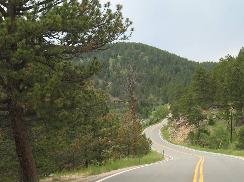
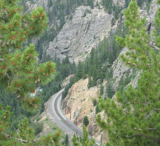
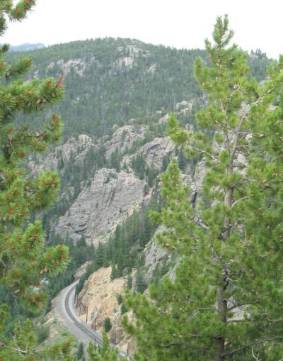
| Colorado Route 72 between Nederland and Denver. Railroad tracks just barely visible to the left of the roadway. |
| 2+ days have passed between the above photos (Friday) and the rest (Monday). A mural "to the right" as you enter Union Station. |
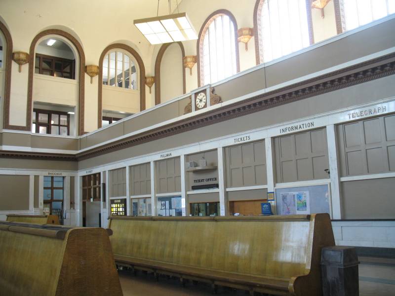
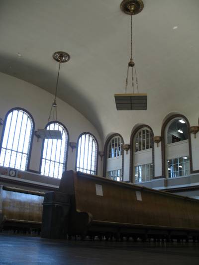
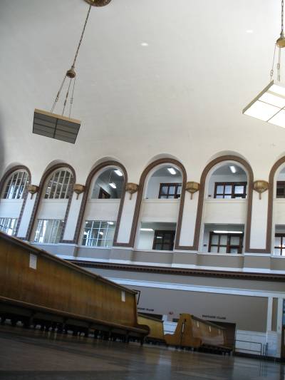
| Inside Untion Station. |
| The mall area |
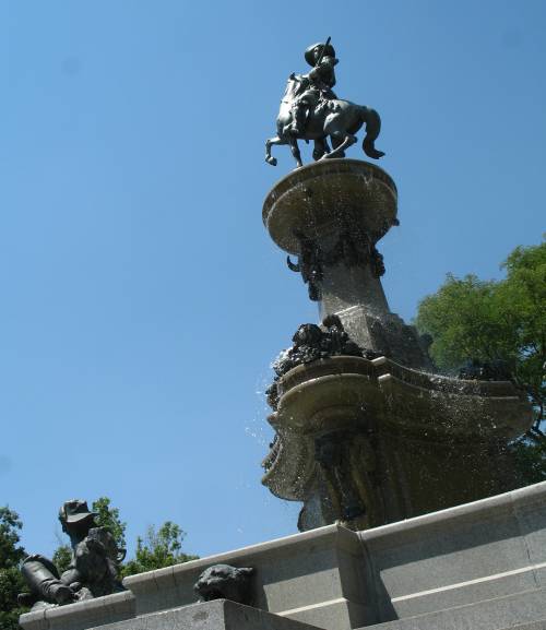
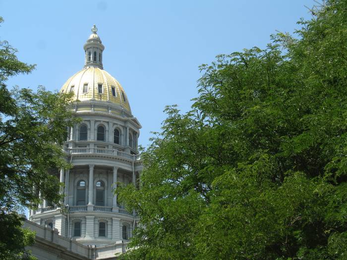
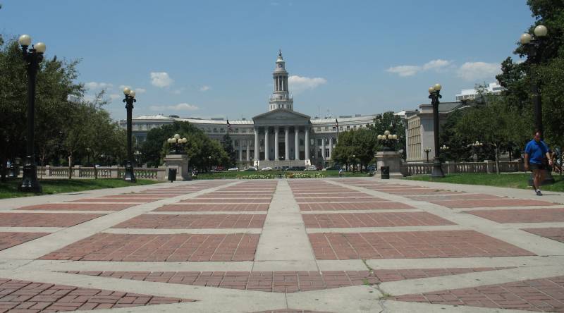
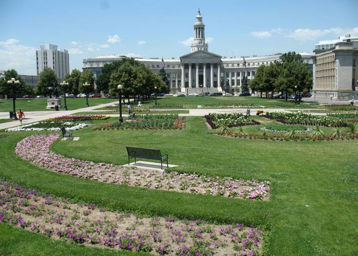
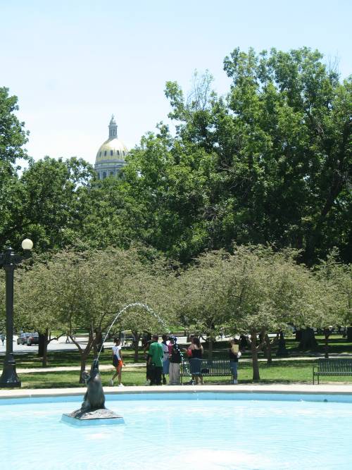
| Fountain near the state capitol |
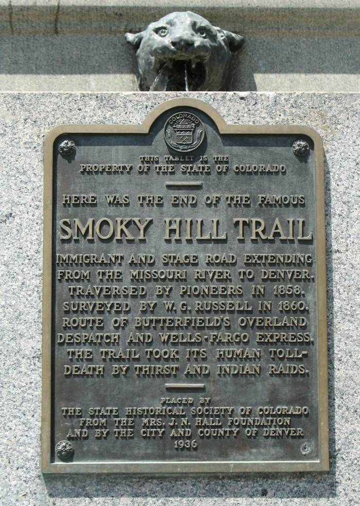
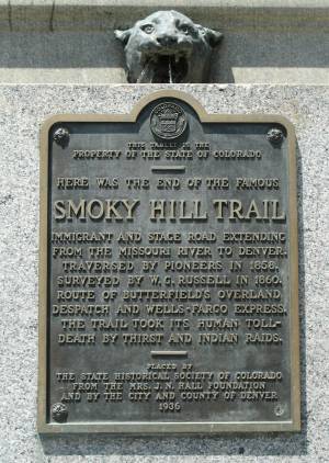
| Info sign on the fountain Click for a larger size |
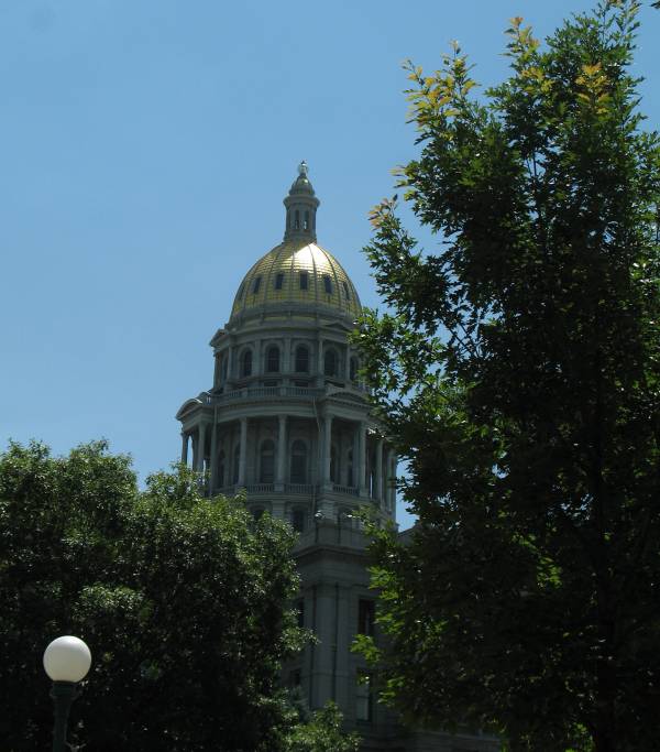
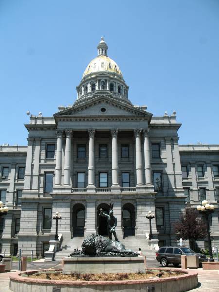
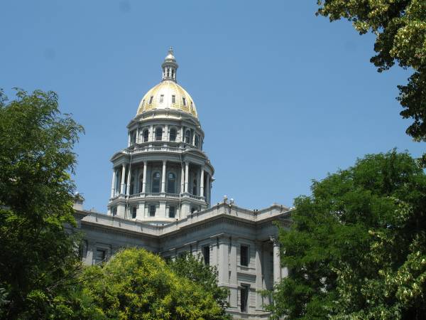
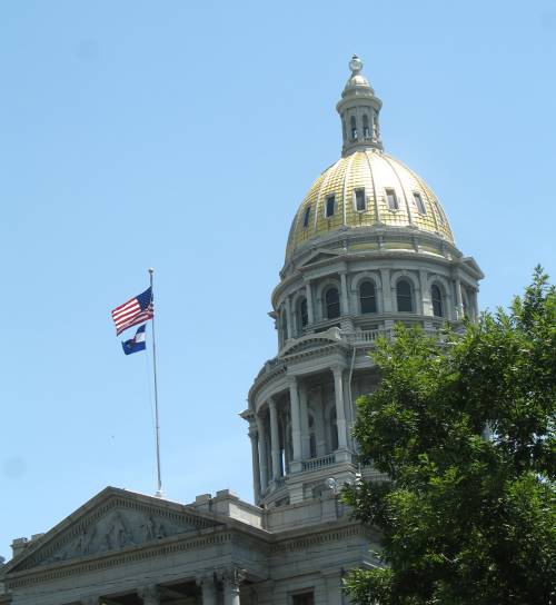
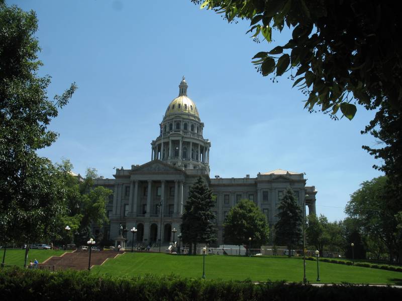
| Capitol building |
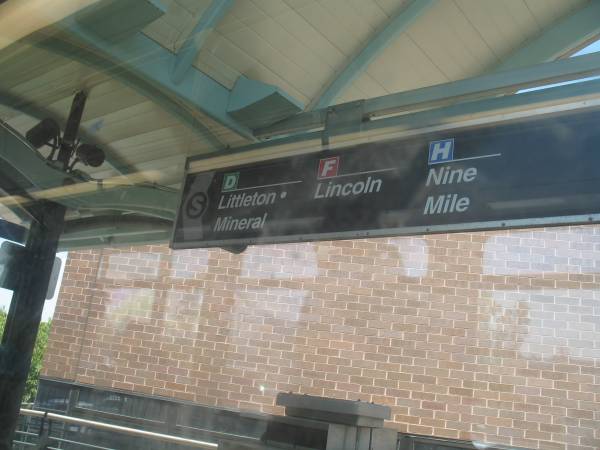
| Denver RTD website My D-Line ride |
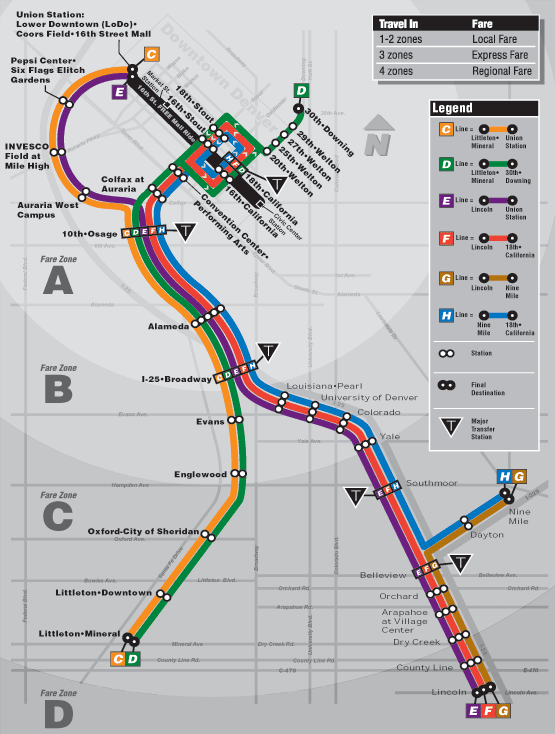
| System map I was on the green line and started at the far bottom left. |
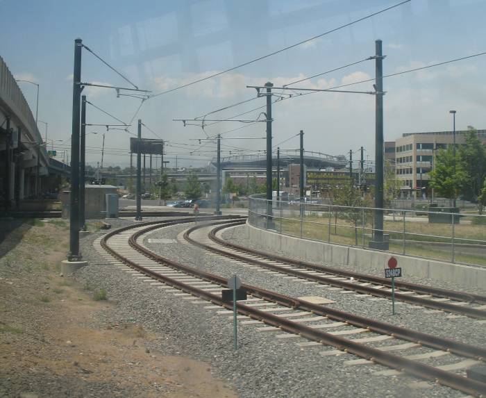
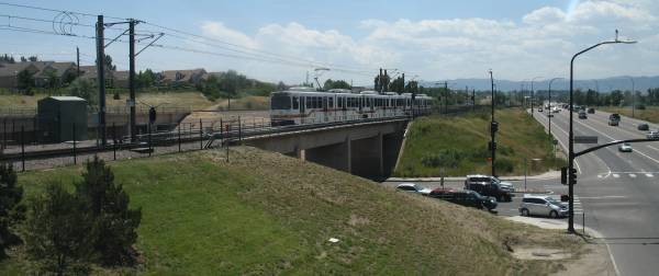
| Electric power via overhead line - different from Chicago's ground based, electrified "third rail" |
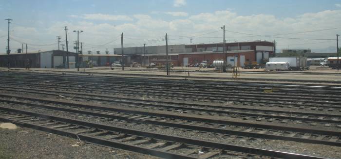
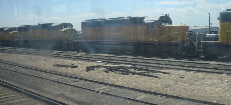
| UP (& BNSF?) yard. |
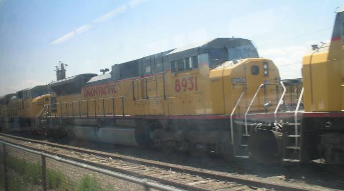
| Twenty current use locomotives in one long line. |
| A bunch of older locomotives as well. |
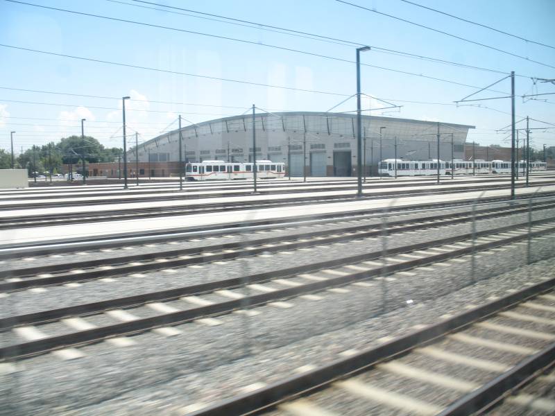
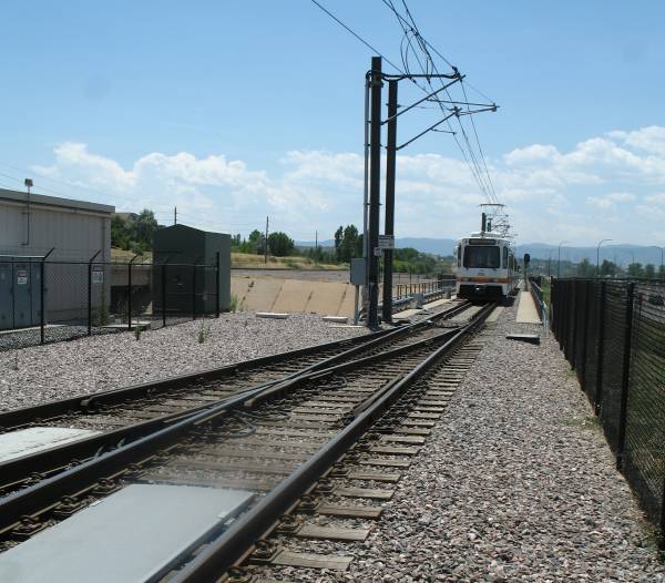
| The car barn for the light rail system. |
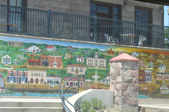
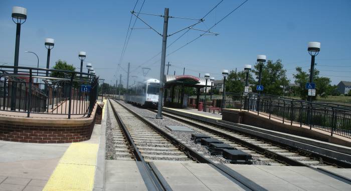
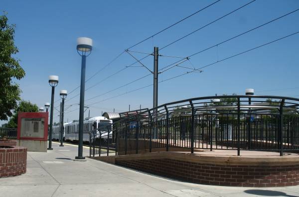
| The second to last stop - mural painting at the station. |
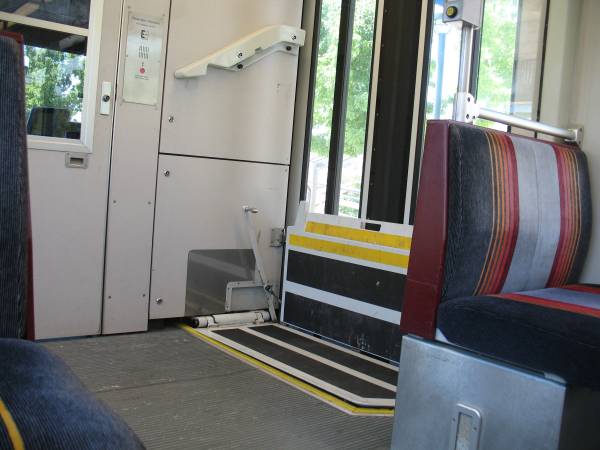
| Wheelchair / stroller access. The train's conductor (behind the door in the photo) will pop out, lower the platform for access. |
| End of the line - the car set rolls down past the switch. The conductor works his/her way to the new head end (possibly cleaning trash as they walk the cars). |
Video
Ride Denver's light rail system
light-rail.wmv
WMV, 11.1 MB, 1 min 44 sec
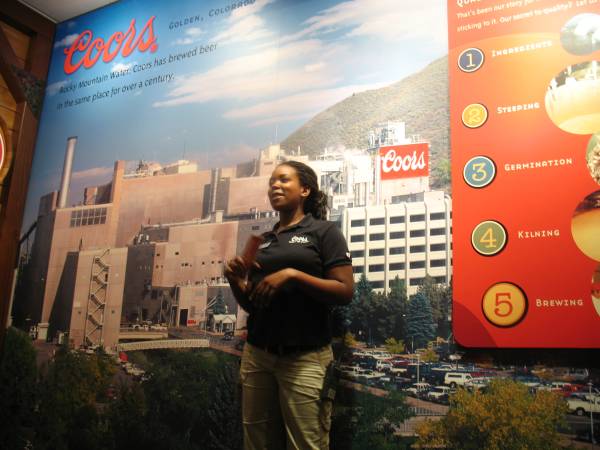
| Dee @ the Coors Brewery tour. |
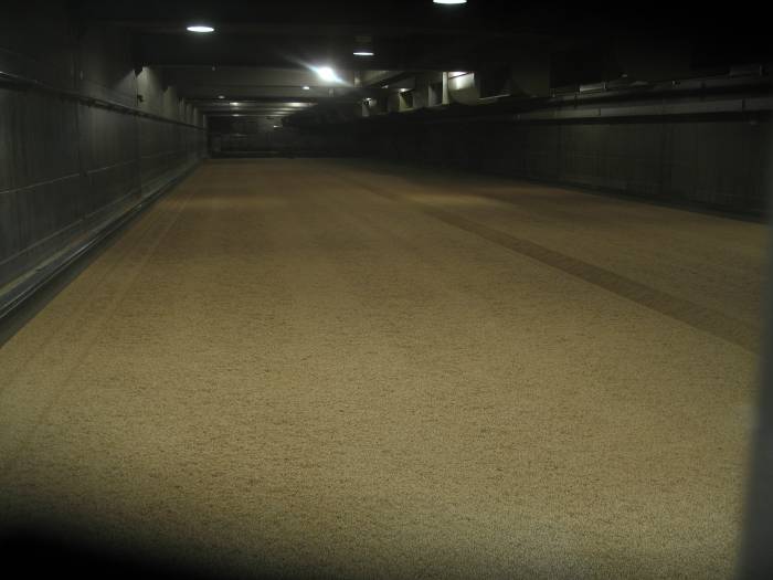
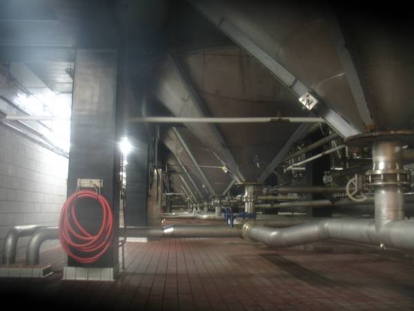
| A kiln (info sign to follow) |
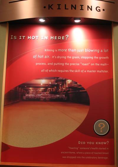
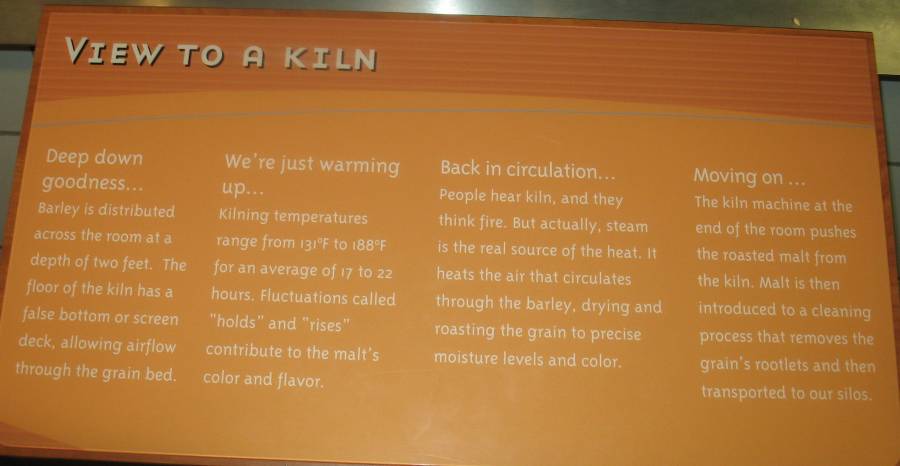
| Info sign - Kilning Click for a larger size |
| Info sign Click for a larger size |
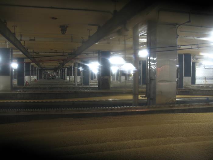
| Germination (info sign to follow) |
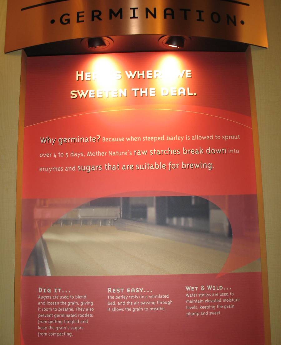
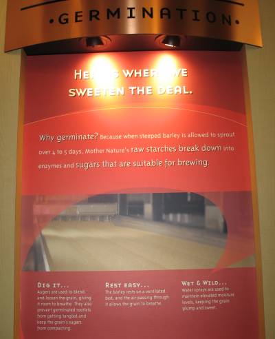
| Info sign - Germination Click for a larger size |
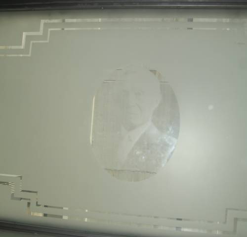
| Portrait in the etched glass. |
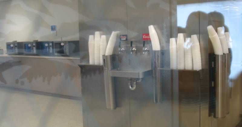
| Cafeteria Nobody knows what the center tap is for - it's never been touched. |
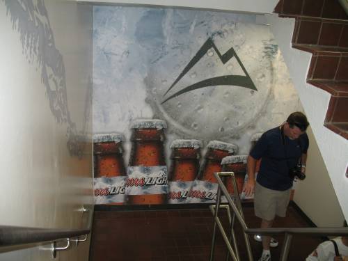
| The stairwells were painted up. |
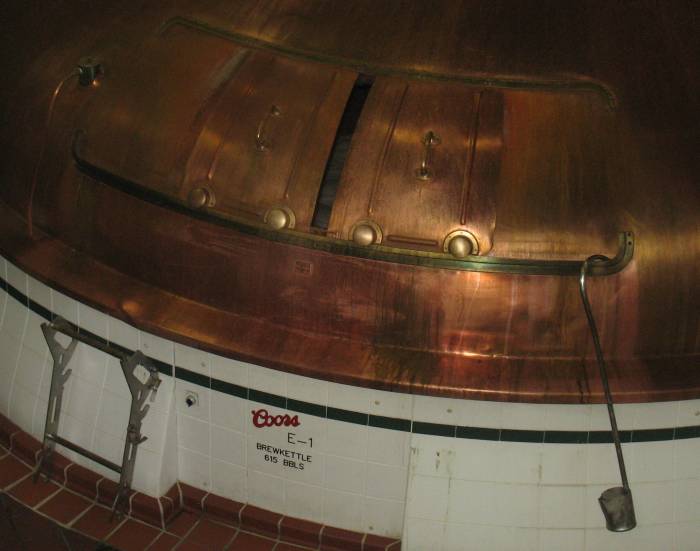
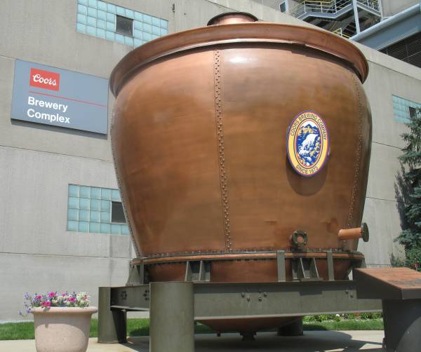
| An original brew kettle |
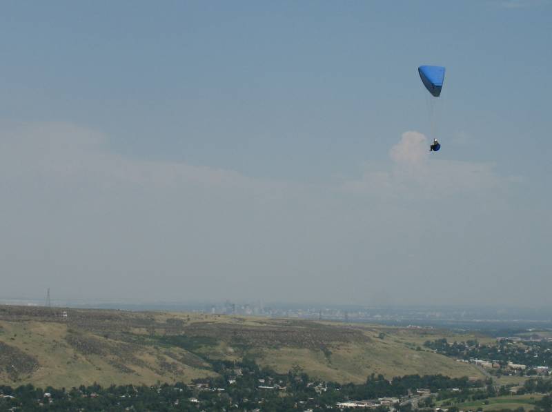
| Paragliders at Lookout Mountain |
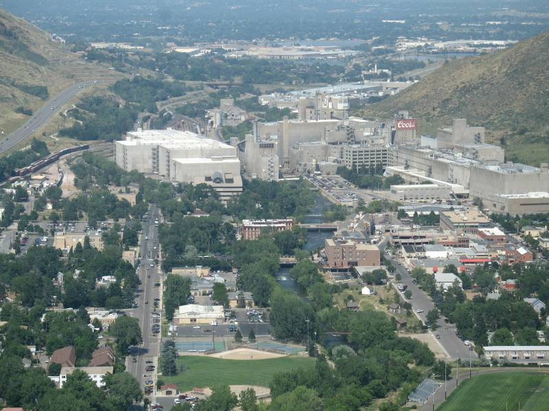
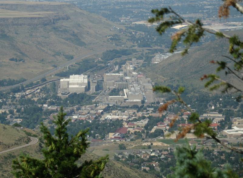
| Looking down on Golden CO and the Coors Brewery |
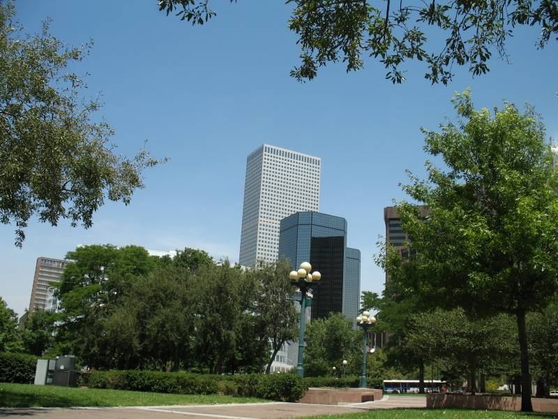
| The high rise buildings in the distance - Denver |
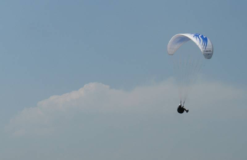
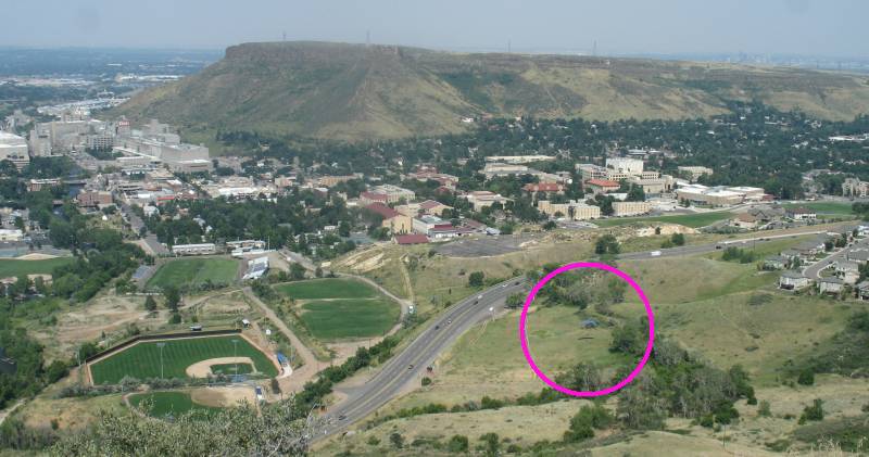
| Video Paragliding paragliding.wmv WMV, 1.7 MB, 28 sec In the circle: The blue wing'd paraglider is just about to land. |
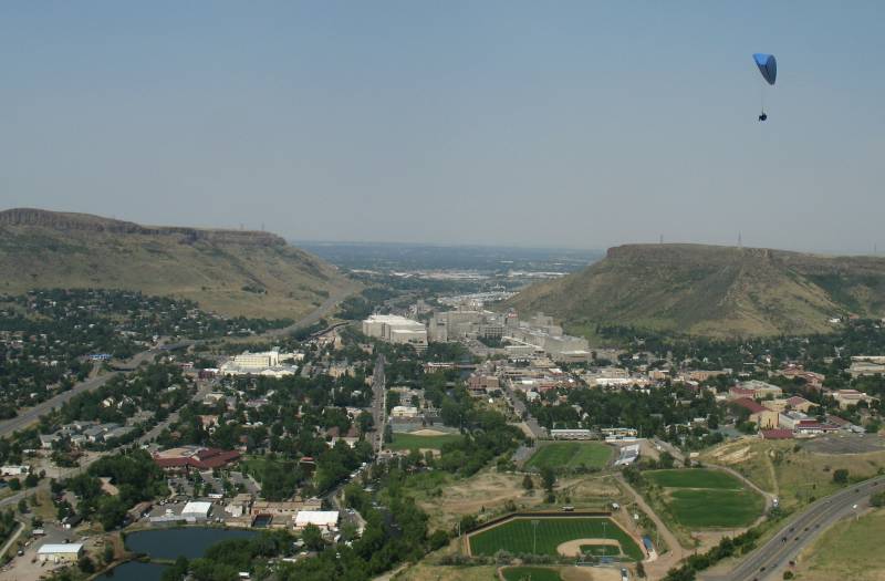
| From higher up the mountain. |
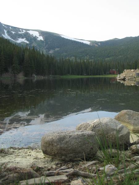
| A couple hours later - Brock is giving me a tour around his neighborhood. I think this is Lake Quivire. St. Mary's Glacier will be off to the left. |
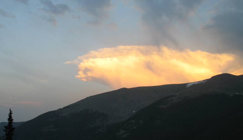
| Some golden clouds - Berthoud Pass area. |
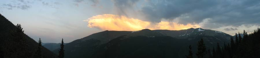
| Panorama Click for a larger size |
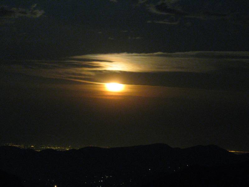
| Our moon from Rocky Mountain National Park |
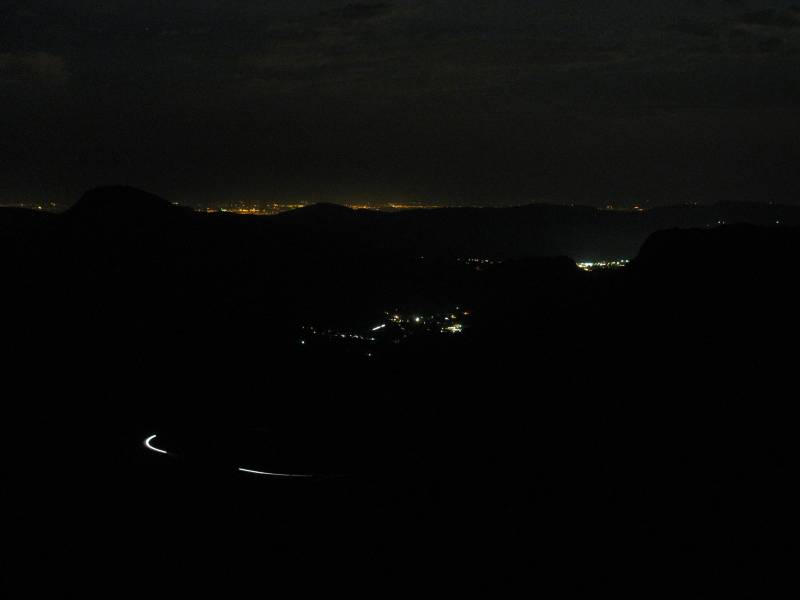
| The "white" lights will be the town of Estes Park. The "golden" lights higher out are the front range cities - about 13 miles away. |