|
Stats
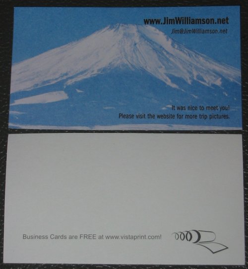
Time September 2, 2005 thru January 2, 2006 - 4 months Overall - 123 Days Riding - 92 (Days that list miles traveled) - 3 months Miles GPS Trip Odometer 23,565.9 miles (includes the approx 43 miles in the back of the pickup). Bike odometer (back calculated from the GPS figures) 48,215.8 start - 71738.7 end. The "tracklog data" is derived from the GPS tracklog data points. I had the GPS set to 0.25 mi recording increments. This data point information is downloaded, daily, into a text file that is then imported into Street Atlas. The resulting data line in Street Atlas lists mileage. That mileage stat is then listed on the main trip page. Adding these mileage numbers up comes out a little different from the GPS Trip Computer. I do not think any of the GPS stats incorporate elevation change distance, therefore, rolling distance might be a bit greater than that listed here. A bicycle cyclometer running from the front wheel might be the most accurate recording device. Tracklog / Street Atlas map miles [add miles from the main trip page] - 23217 (w/o pickup), 23260 (w/ pickup) Tracklog miles - all track logs added together: (need to calculate) Bike odometer - non-functional after about 84 miles out of Bandon, OR. The lower hub has issues (it's done this before - I've replaced parts, lubed the hub, cleaned/lubed the speedo cable - all to reduce the load on the hub assembly) - the metal, dual ear tang has deformed and it does not mesh with the plastic drive gear. On trips I don't use the bike's speedo/ODO as the still camera is in front of it, blocking the view. I use the GPS for speed and ODO functions. So, repairing the speedo/ODO on the bike is a low priority item. Oh, distance around (circumference of) the earth at the equator - 24,900 to 24,902 miles. If I headed back out and added a few of the states not covered the trip could easily reach this magic number. Not gonna happen tho. Fuel: Unknown - not all fuel stops documented. Estimate 35 miles per gallon over 23300 miles. 665 Gallons. Average gallon cost of $2.50 = $1662 in fuel. So if the bike consumed 665 gallons of fuel, and the stoichiometric (optimal fuel-air ratio) ratio is 14.7:1 then the bike, if running optimally (not), would have processed about 9775 "gallons" of air. Well, since it runs more rich than that let's just say 9000 "gallons" of air (1203 cubic feet). With the assumption (calculated below) that the motor processed 88,540,000 rev's and it only pulls in air/fuel 1/2 of that (4 cycle motor) for it's 1098 cc rating it could then pump through 44,270,000 cycles of 1098 cc's of volume - under optimal conditions. This volume calculates out to 48,608,460,000 cc's of volume - assuming optimal conditions. Converted to Cubic Feet this is 1,716,591 cubic feet of air/fuel processed through the motor under optimal conditions. Under my calculated conditions - 9000 gallons of air, 665 gallons of fuel = 9665 gallons of processed volume (1292 cubic feet) - a far cry from the 1,716,591 cubic feet. Perhaps I made a calculation error? Perhaps an assumption is off? Assuming correct calculations, the ratio between the two is 1329:1 (ratio of what the motor was capable of processing to what it actually did process) - I barely opened the throttle! - so for those that actually run through the numbers - if you see an error - e-mail me. Tires: New front, good rear at start of trip. New rear in Anchorage AK (heading out of the state). New front and rear in San Jose, CA. Both tires need to be replaced - rear specifically. Brake Pads: New fronts in Seattle WA. Did I do the rears there too?? New rears in CT. Fronts (thin, but serviceable) will be done again when the tire is changed. Oil & Filter: Not as often as it should have been. I should have set myself up with a dump bag / catch bin. I had no issue buying oil / filters from auto parts stores along the way. Fresh when I left, Anchorage AK, Seattle WA?, San Jose CA, Denver CO, (Key West - should have - didn't), home. Rainy Days: Unknown - but an estimate of 15 to 18 Tips: Unknown (that's a bad thing in itself) but an estimate of 10 perhaps. Hinton AB (1), Mt. Rainier (1), Yosemite (1), that rocky road cutting over to Joshua Tree (????) - see the Addendum page. None from Joshua Tree to home (things are looking up!). Engine Starts: Perhaps 4 to 6 per riding day - 368 to 552 Clutch Lever Pulls: Let's see - this is a wild estimate. Six speed transmission with the first four being regular use gears. Up on the AlCan Hwy the clutch pulls were rare - long hours at speed and only dropping a gear or two in the "towns". In cities clutch pulls are more frequent. Let's just say - 9 full stops per day (some would be 1 to 2 gear downshifts where you keep moving). Each cycle moving from first to fifth then fifth to first. Eight pulls to go up and down through the gears per stop (assuming I stay in first). 92 Riding days. 6624 Clutch pulls. Now I wonder how many revolutions I spent with the clutch throwout bearing in use.... Wheel Revolutions: Measuring the distance - axle to ground - we'll average 13.75 inches for wheel radius. This calculates out to 86.4 inches of circumference. Divide by 12 to get feet = 7.2 feet per revolution. 23,500 miles * 5280 feet in a mile = 124,080,000 feet of travel / 7.2 feet per revolution = 17,233,333 wheel revolutions. Skipping that and looking at a rough 10,000 miles per tire each would see 10,000 miles * 5280 feet per mile = 52,800,000 feet of asphalt / 7.2 feet per revolution = 7,333,333 revolutions. If the wearable tread of the tire is 1/2 inch thick and this 1/2 inch depth of rubber will wear down to "replace it" condition then for each revolution (contact with asphalt) 1/14,666,667 inch (0.00000006818 inch) of rubber needs to be scrubbed off.. The above "scrub off" numbers will be larger as there is more wearable surface of a tire than just the center line. Engine Revolutions: Well, cruising, it sits about 3800 rpm. At 60 mph this is 1 mile per minute. Thus 3800 rev's per mile (cruising). 23300 miles * 3800 revs/mile = 88,540,000 rev's. Wow. Since each cyl fires every other time a spark plug fired 44,270,000 times. Except for that one that didn't fire too well when it rained heavy enough! States: 33 (IL, IA, WI, MN, ND, AK, WA, OR, CA, AZ, NM, CO, TX, LA, MS, AL, FL, GA, SC, NC, VA, DE, PA, NJ, NY, CT, (RI - close but not hit), MA, NH, ME, WV, OH, IN, MI Provinces: 4 (Saskatchewan, Alberta, British Columbia, Yukon Territory) Parks: Headwaters of the Mississippi River / Itasca S.P. (Park Rapids, MN); Banff & Jasper N.P.'s (Banff & Jasper, Alberta, CAN); Kluane Wildlife Sanctuary (YT); Tetlin National Wildlife Refuge (AK); Denali N.P. & Preserve [only from the highway - no interior treks] (AK); Kenai National Wildlife Refuge (AK); Chugach S.P. (AK); Wrangell-St. Elias N.P. & Preserve (AK); Mount Baker-Snoqualmie N.F. / Mount Baker Wilderness (WA); Olympic N.P. * [Hurricane Ridge, Olympic Hot Springs, Hoh Rain Forest, Queets River, Quinault River] (WA); Mt. Rainier N.P. * (WA); Mt. St. Helens National Volcanic Monument * (WA); Siuslaw N.F. (OR); Oregon Dunes N.R.A. (OR); Umpqua N.F. / Crater Lake N.P. (OR); Siskiyou N.F. (OR); Redwood N.P. (CA); Trinity N.F. (CA); Humboldt Redwood S.P. (CA); Marin Headlands S.P. (CA); Big Basin Redwoods S.P. (CA); Los Padres N.F. (CA); Big Sur S.P. (CA); Santa Monica Mountains N.R.A. (CA); Angeles N.F. (CA); San Bernardino N.F. (CA); Joshua Tree N.M.* (CA); Cleveland N.F. (CA); Prescott N.F. (AZ); Coconino N.F. (AZ): Petrified Forest N.P. * (AZ); Tonto N.F. (AZ); Apache N.F. (AZ); Malpais N.M (NM); Santa Fe N.F. (NM); Rio Grande N.F. (CO); Great Sand Dunes N.M. * (CO); Pike N.F. (CO); Big Bend N.P. * (TX); Apalachicola N.F. (FL); Big Cypress National Preserve (FL); Everglades W.M.A. (FL); Acadia N.P. (ME); Quoddy Head S.P. (ME). N.F. - National Forest; N.M. - National Monument; N.P. - National Park; N.R.A. - National Recreation Area; S.P. - State Park; W.M.A. - Wildlife Management Area. * National Parks Pass use (though it seems there were others). Major Bodies of Water: Mississippi River (IL, IA, WI, MN, LA), Yukon River (AK, YT), (Arctic Ocean / Beaufort Sea - not this trip - a reason to return), Pacific Ocean (Gulf of Alaska, WA to CA), Puget Sound (WA), Strait of Juan De Fuca (WA), Columbia River (WA/OR), Crater Lake (OR), San Francisco Bay (CA), Gulf of Mexico (TX to FL), Atlantic Ocean (FL to ME), Chesapeake Bay (VA), Cobscook Bay (ME), Lake Michigan (MI). Time Zones: 5 (Central > Mountain > Pacific > Alaska > Pacific > Mountain > Central > Eastern > Central) Clueless Drivers (that could cause severe harm - I'm sure there were way more clueless drivers): - CA 246, Buellton, CA (I think) - An intersection where oncoming left turn traffic was turning on their protected left turn arrow. It stopped and I then had a green light (they too but it was an intersection where most of the traffic turned left and little traffic came from my direction). There was a small gap (1 car perhaps) between their arrow and the two-way green. I started across the intersection and a pickup just started to turn left in front of me. The operator quickly caught the mistake, straightened and stopped. - De Anza Blvd, Cupertino, CA - mini van wanted to be in the left turn lane - no matter that I was in the lane between where they were and where they wanted to be - 30 mph, no big deal, decent brakes but a debilitatingly LOUD horn would have been appreciated. - US-98, Gulf Breeze, FL - divided four lane, 50/55 mph - driver in a small pickup wanted to merge from the center divider into traffic - let alone that a pack of traffic was heading down the road. Heavy on the brakes - the vehicle to my right did the same - no moving right for some space. The pickup stayed in my lane - I wasn't overly panicked - brakes were working - but hard. The bed of that pickup got HUGE - FAST. Clueless driver - never even jumped on the gas to giddy'up-n-go. Oh to have a button on the handlebars that would freeze a vehicle in its tracks - before it pulled into the traffic stream. Of course there was the standard fair that didn't understand what "Slower traffic must use pullouts", "Slower Traffic Keep Right" or Keep Right, Except to Pass" meant. Even a couple that would "pass" at 0.0005 miles per hour faster than the vehicle they were passing. One of these passes took 9+ MILES. Traffic backed up with loads of ticked drivers (I know there was at least one). Having a higher power to weight vehicle helped with some of these clueless, inconsiderate operators. Oh, to have a button that would make their vehicle slow, pull over, stop, stay there for 20 minutes before resuming. Unpaved Roadway: [~445.8 miles or 1.9% of the trip] Heer & Rush Rds, Hanover IL (graded gravel, 5.2 mi); Closing Dam Rd, Cassville WI (graded gravel/dirt, 4.8 mi dead end / round trip); Upper Des Lacs Lake, Kenmare ND (graded gravel, 11.3 mi); Drinkwater, SK (graded gravel, 5.3 mi); AlCan Hwy construction zones (graded soil, ~20 miles total); Dalton Hwy, Alaska (~170 miles of graded, drying mud); Cassiar Hwy, British Columbia (~30 ?? miles graded soil); Neah Bay, Makah Nation (22.1 miles, graded gravel, mud, two-track); Queets River Road, Montesano WA (graded gravel / soil, 13.7 mi round trip); Quinault Valley, Quinault WA (graded gravel/soil, 26 miles); Mt. Rainier - Carbon River Road (graded soil, 10 miles round trip); N.F. Road #81, Mt. St. Helens (graded soil, 7 miles); Whisky Run Beach, Bandon OR (BEACH RIDING!, 5.8 mi round trip); Sitkum Rd, Dora OR (graded gravel, 21.5 mi); Siskiyou National Forest, Brookings OR (graded soil, two track, and other entertaining obstacles, 46.5 mi); Pinyon Ridge Truck Trail, Littlerock, CA (graded & two-track soil/rock, 14 miles); Smarts Ranch / Burns Canyon Rds, Big Bear City, CA (UGH - rocks, rocks, rocks, then sand, 17 miles round trip); SR << catch that - SR means STATE ROUTE ! 112, El Vado NM (rutted dirt for 15.6 long, bumpy miles) And you might ask - how does he know all of this? With the tracks on a map I could easily re-trace the route - zooming in and out - following along. With the map tools I can readily measure (create a short route) distance. Dashed Lines on the Road: Lots Ferry Rides: 2 WA - Seattle to Bainbridge Island ($6.00 ?, ~ 40 minutes); TX - SR 87 Galveston to Port Bolivar (free, ~ 20 minutes) Bridges: Lots Floating Bridges: 1 - SR 104 over the Hood Canal Longest Bridge: 17 Mile bridge in the Keys (FL)?, Chesapeake Bay Bridge-Tunnel is perhaps second. Tunnel Passes: Whittier AK (1 - round trip) [combination train/auto setup], Yosemite (1 - round trip), Oregon (a few - one-way), Marin Headlands / Sausalito, CA (1 - two or three times), a couple/few tunnels in the NorthEast U.S. in addition to the Chesapeake Bay Bridge-Tunnel. Bugs Hit: Thousands Bugs Eaten: 0 Wildlife Encounters (animals near or on the road): 8 - at least, perhaps 12 at the most. Bison/Buffalo (AlCan Hwy), Moose (Anchorage park), Deer. Wildlife Encounters (that could have ended up very bad for me): 1 - two deer on the 12/30 Trip Entry Performance Awards: 0 (stops - 0) Parking Tickets: 1; Parking Tickets Rescinded: 1 Encounters with Undesirable / Surly People: 0 Encounters with Great People: LOTS! Sunglasses: 3 Face Shields: 3 (just a couple wipes with a glove to get rain off - scratched. Did I mention I dislike riding in the rain...) Earplugs: Etymotic headphone 'rubber' reusable plugs (tried them for a few days - they don't seal out as much sound as te foam style plus they make my ears ache a bit), Etymotic headphone foam replaceable plugs (getting dirty - could be replaced - don't have spares on hand), standard 'foam' earplugs - perhaps 8 or 10 pairs. Riding Apparel: Riding pants - replaced in San Jose - zippers on the old pants were not zipping. AA Batteries: Four batteries to a "set". They go into the still camera first then, when "used" cycle out to the GPS. The still camera consumed perhaps 5 to 7 sets of batteries (20 to 28). The camcorder uses a rechargeable battery. I could use rechargeable AA's for the still cam but I've had poor performance from them. When on the bike all items are bike powered to reduce camera battery needs. Clear UV (bug and rock) Filters for the Still Camera: 2 (though I could use another so it should be 3). They get pitted much like the windshields of our cars. The Gear Review page will have some information on this. Protective Lens for the Helmetcamera: Good at trip start, replaced somewhere around Washington. Extra spares shipped home. Supply Shipments: Three or four boxes of items shipped home - mainly Mini-DV camcorder tapes as well as laptop hard drive data backups (DVD's). Some laptop DVD backups were left at places I was at (friends or family) to be destroyed at trip end (guess I have to make a couple phone calls...). Items shipped TO me - RAM camera mount and a GPS III+ antenna (one box shipped to Denver). Camera mount basically not used. RAM antenna not yet used (existing antenna seemed to dry out and resume good operation). Set of heated gloves and a smaller heated jacket (XL > M) shipped to Mount Pleasant SC. Contact Cards: Before heading out I made some contact cards (click to view) - business cards that had the website and e-mail listed on them. VistaPrint.com - "free" cards ($8.95 shipping). I started with 250 cards and have 58 remaining - 192 given out. I've met many more that I did not hand a card to. Most folks, when given a card, look at the front, flip it over, scan the back, flip it to the front - ask one of these questions: "Did you take this picture?", "Are you a photographer?", "What mountain is this?". No, No - But I take lots of pictures, I don't know (most think it's Mt. Shasta). One thing that has disappointed me a bit - the lack of return e-mails from those I've given a card to. I often ask, when I hand a card out, "send me and e-mail and let me know where we met - I'll remember you." Only a couple e-mails have come back in - not that it's _required_ - just would be nice to hear back. Over 800 unique "people" (IP addresses) have visited the website in the month of December 2005 (with similar stats for the prior three months). There were a few "unsolicited" e-mails - those that came in where I didn't initially meet in person or via a web forum - Heikki in Finland, Chris in South Carolina, Bruce in Nebraska, Bob in Rockford. This brings up another tidbit that I would like to do differently in the future - and a big point I've come to realize on the trip - PEOPLE. The people I've met (those that walk up and start chatting, those that I've met in person from prior Internet groups relationships, and specifically those that I've met in hostels [often world travelers]) - I wish I kept track of each of them. At best a photo, first name, place we met, place they call home. This page, People, details some of my memory of those I met. I created this page post-trip so only a few are coming back to my recollection. Outside of the hostel in Chatanika, AK a lady asked "What's the best thing you've seen so far?" My answer - even at that early stage in the trip - "The people I've met". The saying - "travel alone meet everyone, travel in a group meet the group" certainly is true (it also helped having a bike that "looked" like I was traveling - all sorts of bags strapped onto it). Cell Phone Battery ReCharges: Perhaps 5 - it stayed turned off most of the time (it didn't work at all in Canada or Alaska so I started to use a VOIP software solution on the laptop - VOIPBuster (similar to SkypeOut)). PalmOne Treo 600, Verizon Wireless national plan. "Danger Zones" visited: Tsunami, Volcano, Earthquake - all on the west coast of the U.S. Roaming Charges: 0 Mini-DV Tapes Used: 22. Pictures Taken: 6184 (90% via the Canon PowerShot a40, 10% via the Canon Optura 20 camcorder's still function). Gear review yet to be photo'd. Tubes of Toothpaste (travel size): 4 or 5 Granola Bars: Perhaps 6 to 8 boxes (Nature Valley 'green box'). 6 bars per box. "Watched / Recorded" Sunrises: 1 (Virginia Beach, VA - I'm not a morning person but I _had_ to catch at least one east coast sunrise) "Watched / Recorded" Sunsets: 2 (Neah Bay, WA & Key West, FL) Northern Lights: 1, I think (heading from Anchorage to Tok AK - greenish glow far ahead of me) Elevation - Highest Noted: Don't know - over 8,000 ft MSL, possibly over 10,000 ft MSL (further mapping of the tracklog data may show elevation numbers). Elevation - Lowest Noted: 0 MSL - lots of places along the coasts (the GPS often listed erroneous negative numbers).From South Padre Island, TX all the way through the Keys and back up to New York City I don't think the elevation jumped more than about 80 ft (except on the rare bridge and then to only a hundred feet or so). A long time to see that stat stay in single to only double digits. Here at home it's about 800 to 900 ft. As soon as I started heading inland (CT, PA) the elevation quickly changed to 300 to 500 ft (and more in spots). Fall Foliage Changes: 3 - Up through the change from around Hinton AB through Alaska, Back down through it in British Columbia, Up through it around Georgia / South Carolina. Different Sleeping Locations (78) 8 - Tenting (way too few) 24 - Hostels 37 - Motels (way too many) 2 - Relatives/family 4 - Friends 3 - Web These stats aren't cut and dry - some of the places I "checked out of" only to "check back in" later. Website Size - for those who viewed it ALL 3785 files - 825 MB 3642 JPG pictures - 219 MB 107 GIF pictures - 3.4 MB 1 BMP picture - 49 KB 110 HTML - 3 MB 10 M1V video w/o audio - 71.3 MB 45 MPG video - 515 MB 1 WMV video - 21.6 MB 36 PDF - 3.7 MB 96 Folders Times I've left the oil filler cap off - and then started the bike: 2. While I recall the stat to be "2" I don't recall both occurrances. The one I do recall was up in Canada - on the way down to Seattle. A gent pulled into the fuel station near me - a pickup towing a nice, white RV. I started the bike and immediately knew I left the cap off. With the cap thus fastened I noted the mist coating on the pavement between the bike and the RV - and then noticed the side of the RV. Instead of simply skating out - I at least notified the driver that the side of the RV will "attract some dirt". Time Spent on Website Content: HOURS. You recall from above a full month that 'disappeared'...... $$ Cost: More than I wanted to spend. I tried to hit the $50 / day range ($20 hostel, $20 fuel, $10 food) but hotels would exceed this figure (though some hotels were in the $25 / night range). |